
OUR SOLUTIONS


Sustainability demands coupled with technological disruption are bringing in a paradigm shift for the power transmission & distribution industry in terms of management of assets, operations, people, and technology.
Read more

The AEC industry is witnessing unprecedented change. The amplified need for construction and infrastructure services across the globe has exacted immense pressure on AEC professionals, creating challenges like supply chain holdups, changing regulatory requirements, resource shortages, and rising costs.Read more

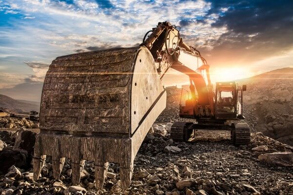
The Oil & Gas business is a critical pillar of the world economy because it drives advancement, development, and the fulfillment of fundamental human needs. Additionally, it is a capital-intensive industry involving substantial costs and revenues. The constantly shifting dynamics of this sector encourage ongoing attempts to boost efficiency and reduce risk.Read more

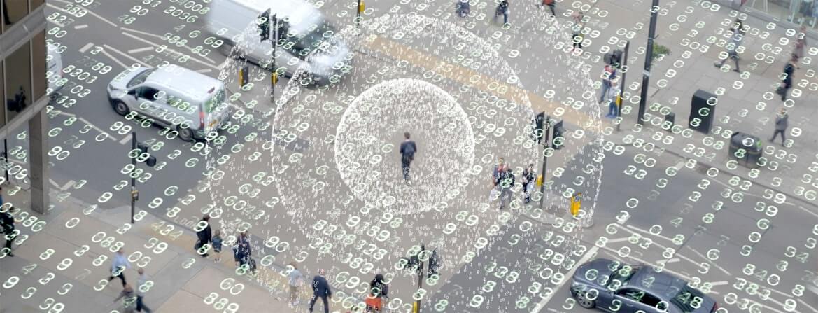
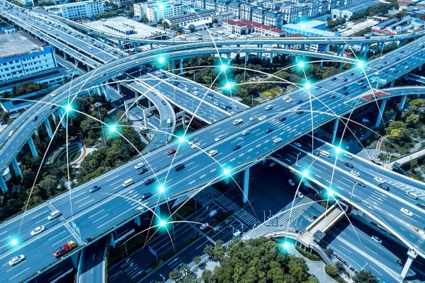
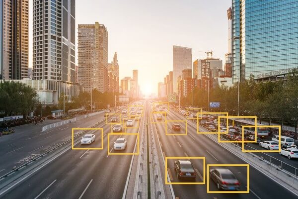
Rapid urbanization and the ever-growing population have elicited the demand for safe, expedient, and cost-effective transportation solutions. The availability of critical data is the key to empowering such smart, integrated, and efficient solutions.
Read more

Modern-day networks are rapidly evolving. Rising demand for greater and improved connectivity with a constant quest for high bandwidth to facilitate autonomous operations is compelling telecom service providers to re-imagine their network capabilities to ensure optimal performance and scalability. Additionally, these service providers have to constantly navigate challenges like lack of collaboration between new-age networks and legacy systems.Read more

The confrontational relationship between the environment and industrial development is clearly demonstrating the fault in its scheme. With unchecked development come issues like environmental obliteration, loss of habitat, pollution, and increased emissions from deforestation. Additionally, climate change, which is the greatest challenge of the century, is negatively impacting natural ecosystems, both globally and locally. Read more


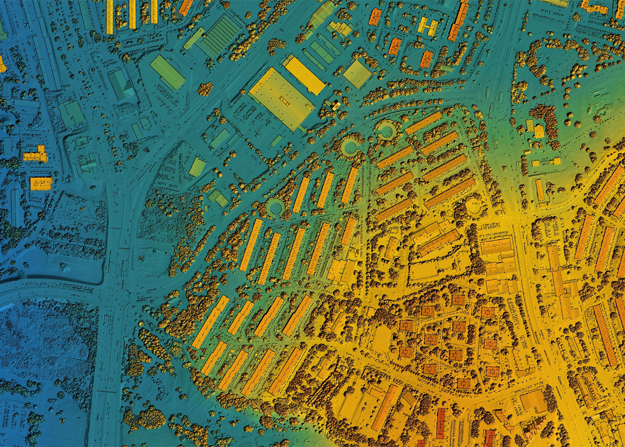
Geospatial information is immensely applicable across a broad spectrum of human activities. Right from conducting exploration in the Oil & Gas industry and engineering smart city solutions to efficient energy management and disaster controlling, geo-referenced data can fine-tune operations across different industry verticals.
Read more


The solutions portfolio at Ceinsys encompasses several complementary technologies that facilitate the development of customized solutions for our services. Our long-standing associations with world-class OEMs like ESRI, Autodesk, Bentley, Maxar, Schneider, and Seimens help us deliver quality and value-driven solutions across a range of industry verticals. Read more

‘Smarter’ solutions ensure better quality of life with superior core infrastructure, cleaner environment and sustainable development. Enhancing possibilities for citizens of today and tomorrow, Ceinsys smart city solutions are holistic and inclusive.
Read more

Enhancing Possibilities in disaster management is all about creating a proactive, data-driven and technology-led framework to manage disastrous events and making relief plan to mitigate risks.Read more

Utilities face operational and maintenance challenges with vegetation management, and there is significant internal and external pressure to improve efficiency. Manual survey and identification of vegetation that requires pruning, trimming, or removal is not effective enough.Read more

Geographical (spatial) data is often underutilised due to its inherent complexities, multifarious origins, duplication, and multiple data formats, making it difficult to share and utilise across different stakeholders. Read more

Turnkey solutions enabling customers overcome the typical challenges of reliability, flexibility, commercial viability. Read more

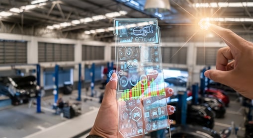
Product Engineering and Manufacturing Engineering activities to help customers in this segment, which is undergoing a paradigm shift on account of rapid growth in the infrastructure development activities.Read more
End to End vehicle portfolio management covering all product development phases –right from initial style development to prototype build and validation. With expertise in developing both conventional and electric models. Read more

From benchmarking to style, concept definitions to ergonomics, from surface check to fit function. Today, smart technology is redefining the entire manufacturing ecosystem and beyond. Build the new age way with solutions that generate real value with extreme effectiveness.
Read more
From benchmarking to style, concept definitions to ergonomics, from surface check to fit function. Today, smart technology is redefining the entire manufacturing ecosystem and beyond. Build the new age way with solutions that generate real value with extreme effectiveness.
Read more
From benchmarking to style, concept definitions to ergonomics, from surface check to fit function. Today, smart technology is redefining the entire manufacturing ecosystem and beyond. Build the new age way with solutions that generate real value with extreme effectiveness.
Read more
From benchmarking to style, concept definitions to ergonomics, from surface check to fit function. Today, smart technology is redefining the entire manufacturing ecosystem and beyond. Build the new age way with solutions that generate real value with extreme effectiveness.
Read more
From benchmarking to style, concept definitions to ergonomics, from surface check to fit function. Today, smart technology is redefining the entire manufacturing ecosystem and beyond. Build the new age way with solutions that generate real value with extreme effectiveness.
Read more
From benchmarking to style, concept definitions to ergonomics, from surface check to fit function. Today, smart technology is redefining the entire manufacturing ecosystem and beyond. Build the new age way with solutions that generate real value with extreme effectiveness.
Read more
From benchmarking to style, concept definitions to ergonomics, from surface check to fit function. Today, smart technology is redefining the entire manufacturing ecosystem and beyond. Build the new age way with solutions that generate real value with extreme effectiveness.
Read more
From benchmarking to style, concept definitions to ergonomics, from surface check to fit function. Today, smart technology is redefining the entire manufacturing ecosystem and beyond. Build the new age way with solutions that generate real value with extreme effectiveness.
Read more
Our comprehensive suite of solutions is created keeping in mind the evolving needs of the automotive manufacturing Industry. Be it virtual validation or electrification, Ceinsys is partnering organisations in achieving their goals – faster, more economical and with greater confidence in the outcomes.
Our comprehensive suite of solutions is created keeping in mind the evolving needs of the automotive manufacturing Industry. Be it virtual validation or electrification, Ceinsys is partnering organisations in achieving their goals – faster, more economical and with greater confidence in the outcomes.

With the fourth paradigm in technology approaching in a hasty manner. Spectra of consumers are keen on taking the incorporation of tech in their daily lives to the next level. A new way to communicate, experience and immerse in the virtual world in the form Virtual reality has seen emergence in demand. A constant pursuit for emulating reality and go beyond it is on the way. The future of VR in business is already emergent, and the world is excited to see what comes next.
Meg-Nxt is striving to enable our clientele to engage with the virtual, in life like detail whether for education, entertainment or analytics. With our products and services for businesses, institutions and end consumer alike, we are your technology partner for all things virtual.
Geospatial analytics can gather time- and position-specific (“geo-referenced”) data about almost any occurrence thanks to modern technology like mobile devices, location sensors, social media, and others. By using this data to create maps, graphs, statistics, and cartograms, geospatial analysis helps people grasp complex relationships. These kinds of representations can highlight current as well as historical trends. Even those that are likely to happen in the future can be indicated.
With a highly agile and cost-effective approach, Ceinsys deliver high-quality geospatial data that enables effective decision-making at scale and across industries. From the evaluation of suitability and capability to estimation and prediction, our analytical solutions lend new perspectives to insights.
A feasibility analysis aids in understanding whether a proposed project is truly viable and achievable. Our custom model solutions leverage the power of GIS to analyze and interpret topographic features and create thematic maps to assist planners and civil engineers.
Our team of analysts possesses complete economic and financial knowledge that enables us to undertake work in areas such as land suitability analysis, evaluating the need for infrastructure upgrade, project design & ROI assessments, and resource assessments.
Improving asset performance, reliability, and safety are among the top priorities for businesses today. Ceinsys’s predictive analytics and risk estimation services enable the development of predictive models that reveal buried patterns, identify risks and opportunities, and deliver timely, data-driven insights. From optimizing internal processes to issuing early warning signals about equipment failures, our solutions help to drastically improve mission-critical outcomes.
The landscape undergoes continuous changes as a result of natural forces and human activities, which has a direct impact on planning and development. However, visually identifying these changes in massive geographic datasets is a tedious process that may lead to inadequacies.
Ceinsys’ advanced imagery analysis helps in the quick and efficient identification of areas that have changed over time. Our change management & spatial detection solutions expedite the whole process of impact analysis and decision-making for Landcover/Land use analytics, Vegetation management, utility ROW management, disaster impact analytics, and more.
While it is impossible to stop disasters from occurring altogether, GIS can help mitigate risks to infrastructure by enabling enterprises to track, predict, and prepare for disasters, and eventually assist in relief and recovery. Our GIS-enabled impact analytics support pre-event disaster modeling, vulnerability analysis, risk reduction & response planning as well as post-disaster recovery & response activities.
By integrating historical data & data from various stakeholders, we facilitate quick dissemination of critical information in a timely manner in cases of emergencies as well as informed planning for risk mitigation. Our solutions are aimed at protecting public health, minimizing damage, and saving lives.