


 Tech Play
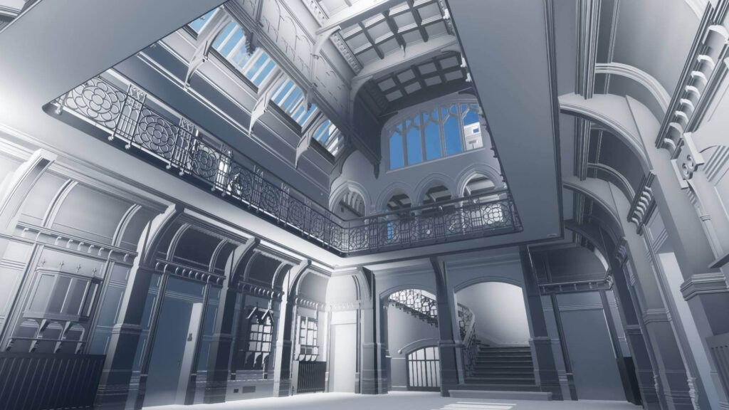
Heritage Conservation using BIM based Architectural & Structural Modelling
Heritage of a nation represents its rich culture and preserving and conserving the heritage of a place depicts historic culture of any city. Heritage modelling includes virtually recreating the age-old structures and create it’s as-built drawings. The technology like remote sensing is the most effective to document these sites, monitor these changes and improve planning. A well-defined 3D model and its walkthrough are created with a sole purpose of restoration and tourism promotion of the archeological monument.
Ceinsys has carried out the archaeological restoration activity by following the standard activities:
- Data Acquisition using Terrestrial Laser Scanner (TLS) and Unmanned Aerial Vehicle (UAV)
- Integration of TLS data and Point cloud data obtained from UAV
- Generating 3D Model
- Creating of Walkthrough of the monument
- Creation of Engineering Drawings
The solution engages virtual model creation using landbase mapping, extracting 2D drawing, generation of 3D model and detailed walkthroughs. Once the data is acquired, an as-built drawing of the structure is created. This forms the base of the model to be regenerated. The final output is the BIM model which consists of the details of the to-be structure in-case a restructuring is required.
Key Project Highlights –
- Restoration of cultural heritage aiding in rebuilding the structure as and when required.
- Encroachments can be identified based on the 3D model visualized
- Detailed engineering estimates.
- Promotion of tourism