


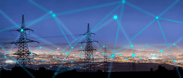


Sustainability demands coupled with technological disruption are bringing in a paradigm shift for the power transmission & distribution industry in terms of management of assets, operations, people, and technology.
Read more

The AEC industry is witnessing unprecedented change. The amplified need for construction and infrastructure services across the globe has exacted immense pressure on AEC professionals, creating challenges like supply chain holdups, changing regulatory requirements, resource shortages, and rising costs.Read more

The Oil & Gas business is a critical pillar of the world economy because it drives advancement, development, and the fulfillment of fundamental human needs. Additionally, it is a capital-intensive industry involving substantial costs and revenues. The constantly shifting dynamics of this sector encourage ongoing attempts to boost efficiency and reduce risk.Read more

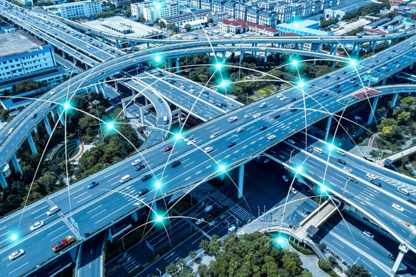
Rapid urbanization and the ever-growing population have elicited the demand for safe, expedient, and cost-effective transportation solutions. The availability of critical data is the key to empowering such smart, integrated, and efficient solutions.
Read more

Modern-day networks are rapidly evolving. Rising demand for greater and improved connectivity with a constant quest for high bandwidth to facilitate autonomous operations is compelling telecom service providers to re-imagine their network capabilities to ensure optimal performance and scalability. Additionally, these service providers have to constantly navigate challenges like lack of collaboration between new-age networks and legacy systems.Read more

The confrontational relationship between the environment and industrial development is clearly demonstrating the fault in its scheme. With unchecked development come issues like environmental obliteration, loss of habitat, pollution, and increased emissions from deforestation. Additionally, climate change, which is the greatest challenge of the century, is negatively impacting natural ecosystems, both globally and locally. Read more


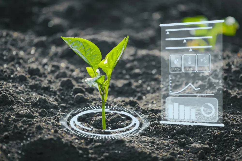
Geospatial information is immensely applicable across a broad spectrum of human activities. Right from conducting exploration in the Oil & Gas industry and engineering smart city solutions to efficient energy management and disaster controlling, geo-referenced data can fine-tune operations across different industry verticals.
Read more


The solutions portfolio at Ceinsys encompasses several complementary technologies that facilitate the development of customized solutions for our services. Our long-standing associations with world-class OEMs like ESRI, Autodesk, Bentley, Maxar, Schneider, and Seimens help us deliver quality and value-driven solutions across a range of industry verticals. Read more

‘Smarter’ solutions ensure better quality of life with superior core infrastructure, cleaner environment and sustainable development. Enhancing possibilities for citizens of today and tomorrow, Ceinsys smart city solutions are holistic and inclusive.
Read more

Enhancing Possibilities in disaster management is all about creating a proactive, data-driven and technology-led framework to manage disastrous events and making relief plan to mitigate risks.Read more

Utilities face operational and maintenance challenges with vegetation management, and there is significant internal and external pressure to improve efficiency. Manual survey and identification of vegetation that requires pruning, trimming, or removal is not effective enough.Read more

Geographical (spatial) data is often underutilised due to its inherent complexities, multifarious origins, duplication, and multiple data formats, making it difficult to share and utilise across different stakeholders. Read more

Turnkey solutions enabling customers overcome the typical challenges of reliability, flexibility, commercial viability. Read more

Product Engineering and Manufacturing Engineering activities to help customers in this segment, which is undergoing a paradigm shift on account of rapid growth in the infrastructure development activities.Read more

End to End vehicle portfolio management covering all product development phases –right from initial style development to prototype build and validation. With expertise in developing both conventional and electric models. Read more

From benchmarking to style, concept definitions to ergonomics, from surface check to fit function. Today, smart technology is redefining the entire manufacturing ecosystem and beyond. Build the new age way with solutions that generate real value with extreme effectiveness.
Read more
From benchmarking to style, concept definitions to ergonomics, from surface check to fit function. Today, smart technology is redefining the entire manufacturing ecosystem and beyond. Build the new age way with solutions that generate real value with extreme effectiveness.
Read more
From benchmarking to style, concept definitions to ergonomics, from surface check to fit function. Today, smart technology is redefining the entire manufacturing ecosystem and beyond. Build the new age way with solutions that generate real value with extreme effectiveness.
Read more
From benchmarking to style, concept definitions to ergonomics, from surface check to fit function. Today, smart technology is redefining the entire manufacturing ecosystem and beyond. Build the new age way with solutions that generate real value with extreme effectiveness.
Read more
From benchmarking to style, concept definitions to ergonomics, from surface check to fit function. Today, smart technology is redefining the entire manufacturing ecosystem and beyond. Build the new age way with solutions that generate real value with extreme effectiveness.
Read more
From benchmarking to style, concept definitions to ergonomics, from surface check to fit function. Today, smart technology is redefining the entire manufacturing ecosystem and beyond. Build the new age way with solutions that generate real value with extreme effectiveness.
Read more
From benchmarking to style, concept definitions to ergonomics, from surface check to fit function. Today, smart technology is redefining the entire manufacturing ecosystem and beyond. Build the new age way with solutions that generate real value with extreme effectiveness.
Read more
From benchmarking to style, concept definitions to ergonomics, from surface check to fit function. Today, smart technology is redefining the entire manufacturing ecosystem and beyond. Build the new age way with solutions that generate real value with extreme effectiveness.
Read more
Our comprehensive suite of solutions is created keeping in mind the evolving needs of the automotive manufacturing Industry. Be it virtual validation or electrification, Ceinsys is partnering organisations in achieving their goals – faster, more economical and with greater confidence in the outcomes.

Our comprehensive suite of solutions is created keeping in mind the evolving needs of the automotive manufacturing Industry. Be it virtual validation or electrification, Ceinsys is partnering organisations in achieving their goals – faster, more economical and with greater confidence in the outcomes.

With the fourth paradigm in technology approaching in a hasty manner. Spectra of consumers are keen on taking the incorporation of tech in their daily lives to the next level. A new way to communicate, experience and immerse in the virtual world in the form Virtual reality has seen emergence in demand. A constant pursuit for emulating reality and go beyond it is on the way. The future of VR in business is already emergent, and the world is excited to see what comes next.
Meg-Nxt is striving to enable our clientele to engage with the virtual, in life like detail whether for education, entertainment or analytics. With our products and services for businesses, institutions and end consumer alike, we are your technology partner for all things virtual.
Augmenting the capacity of highways through an amalgamation equating DPMS, 5DBIM and GIS with the crux of 4th and 5th dimension i.e., time and cost to enhance the decision-making capability.
Land management has always been a challenge for the Government. There has always been a need of some smart solutions to tackle the challenges and provide an efficient solution for the decision makers. Ceinsys addressed this challenge and has been helping various authorities in informed decision making.
Infrastructure growth and demand has been increasing since last decade which has led to
increasing citizen demands. As Citizen Demand grows the regularization of all services and mapping of all assets becomes most important aspect of city administration.
Develop and deploy state-of-the-art centralized ICT platform for the state which could integrate data from multiple sources and provide seamless access of information over user friendly platforms including Web and mobile platforms
Property tax is the major source of revenue for most of the Urban Local Bodies (ULBs) across the country. But tax collection has always been a pain point for the revenue departments. The development of appropriate GIS has considerable potential to improve municipal planning, administration, and management in a number of ways.
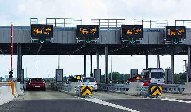
Under the TOT model, right of collection of user fee of selected operational NH projects is proposed to be assigned for a specific time period, to developers or investors (Concessionaire) against upfront payment of a lump-sum amount to the Authority.
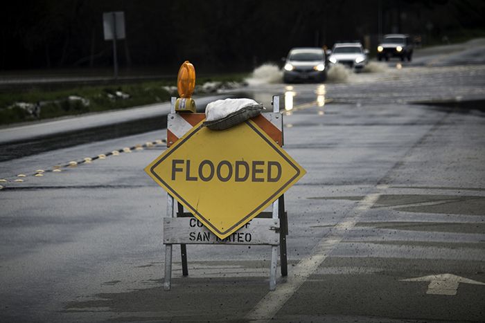
Floods are major natural disasters that cause significant damage and loss of life. State disaster management agencies, disaster relief departments, and revenue authorities are often overwhelmed by the scale of a flood disaster. Geographic information systems (GIS) and remote sensing using satellite imagery play a vital role in analyzing flood hazard data.
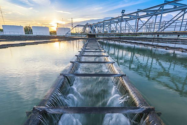
When it comes to smart cities, water infrastructure and safe drinking water are of utmost importance. Rural and urban infrastructure both demands continuous monitoring and checking of functioning of the infrastructure
Bharat Sanchar Nigam Limited (BSNL), is the largest Indian state-owned telecommunications company. The company is pioneer in Indian telecom industry and operating through more than 30 circles / regions. BSNL planned to digitally map its route for creation of the As-Built drawings of the existing and future network assets in order to generate a centralized GIS based Optical Fibre Cable (OFC) Network Management system.
Water is a limited commodity, whereas demands for agriculture, industry, domestic use, power generation, flood control, navigation, etc. are ever-growing. The water resources in Maharashtra, a state of India, are limited and unevenly distributed to meet the actual demands of the respective regions.
Tree census is the process of documenting all the trees and their important attributes from a given area that characterizes trees and their locations which can be used to achieve management objectives.
RAPDRP- Restructured Accelerated Power Development & Reforms Programme, a central sector program was launched by Indian Government with an aim to reduce AT&C losses, Energy accounting and auditing & Enforcement of Transparency in business operation.
Central Electricity Supply Utility Limited (CESU), is the regional unit of Orissa which serves medium voltage power transmission and distribution in central region of the State and ensures that the customers receive the highest quality of customer service available in the state.
Heritage of a nation represents its rich culture and preserving and conserving the heritage of a place depicts historic culture of any city. Heritage modelling includes virtually recreating the age-old structures and create it’s as-built drawings
Mining is a CAPEX oriented industry. From exploring minerals to capitalizing the entire process, the cost is high and so is the ROI. India has many mineral rich states and concerted efforts have been made to systematically explore and develop the mineral resources in the country.
Basemaps are always the heart and soul of any GIS project. The State of Maharashtra took initiatives to capture the entire land area and create a landbase as a part of National GIS as laid down by Planning Commission.
The Ministry of Jalshakti, State Water and Sanitation Mission (SWSM), Water Supply and Sanitation Department (WSSD), Government of Maharashtra, launched the Jal Jeevan Mission programme with the main goal of guaranteeing fair and high-quality water delivery to rural home users.